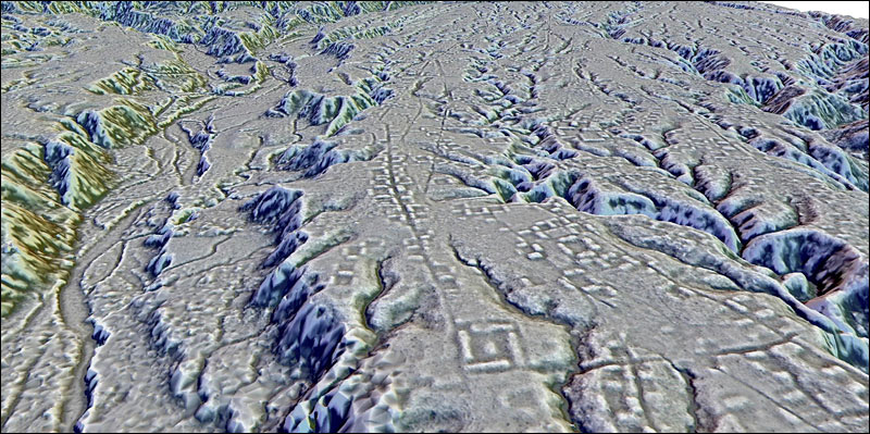
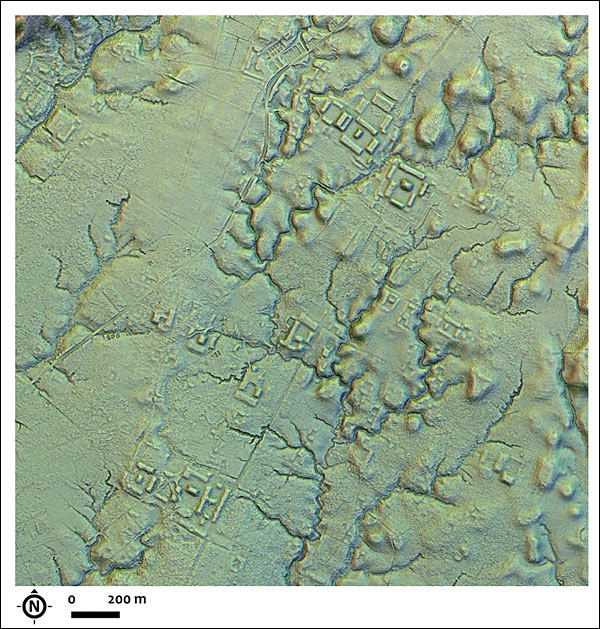
A new type of laser mapping technology known as LIDAR reveals lost cities in the foothills of the Ecuadorian Andes.
[UPDATE: This is actually summarized from this AP article:]
A cluster of lost cities has been reported as discovered in Ecuador, South America, which were established around 500 B.C. and were habituated for about 1,000 years. The area is estimated to have been home to at least 10,000 farmers and perhaps as many as 30,000 at its peak.
Recent mapping by laser-sensor LIDAR technology reveals the lost cities which was a dense network of settlements and roadways in the forested foothills of the Andes.
The settlements date to about the same time period as the Roman Empire, and it predates the Aztec, Incan, and Mayan civilizations. [Note: But it does not predate the much older Caral pyramids in Peru that date to about the same time period as the Egyptian pyramids.]
Earthen mounds and buried roads in the area were first noticed more than two decades ago by the archeologist Stéphen Rostain, who said he initially was not sure of how it all fit together. He has recently reported his findings in the journal Science.
The people who inhabited the area are called the “Upano.” Instead of building with stone as the Incans and Mayans did, they built with mud in an elaborate system of organized labor.
The buildings were residential and ceremonial and they were erected on more than 6,000 earthen mounds, where they were surrounded by agricultural fields with drainage canals. The largest roads were 10 meters wide and stretched for 6 to 12 miles.
[Note: January 21, 2024— I’m very impressed with Native American culture, I think it is amazing how they accomplished what they did without having contact with other cultures. See the videos on this page. This video is one of my favorites (personally I recommend watching the second one in the series that I linked to here before the first one.)]